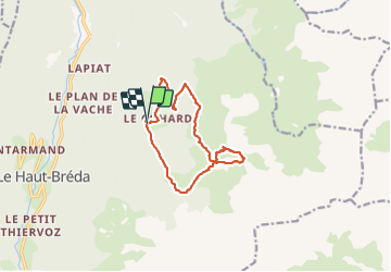
![](/images/other/stat-length.png)
![Excursión Senderismo Le Haut-Bréda - Montagne de Périoule - Photo](https://media.geolcdn.com/t/1900/400/2f5383cd-a0ab-4c06-9cbc-7601a3f9dca7.jpg&format=pjpeg&maxdim=2)
Montagne de Périoule
nadd73
Usuario GUIDE
![Longitud](/images/other/stat-length.png)
![Altitud máxima](https://static1.geolcdn.com/siteimages/upload/files/1508320355ic_sort_altitude_max_24dp.png)
![Desnivel positivo](https://static1.geolcdn.com/siteimages/upload/files/1508320355ic_sort_den_pos_24dp.png)
![Km-Effort](/images/other/stat-length.png)
![Altitud mínima](https://static1.geolcdn.com/siteimages/upload/files/1508320355ic_sort_altitude_min_24dp.png)
![Desnivel negativo](https://static1.geolcdn.com/siteimages/upload/files/1508320355ic_sort_den_neg_24dp.png)
![Boucle](https://static1.geolcdn.com/siteimages/upload/files/16400158638029165_repeat_loop_refresh_sync_direction_icon.png)
![Senderismo](https://static1.geolcdn.com/sitytour/trail-icons/101.png)
4h36
Dificultad : Difícil
![Escanee este código QR para abrir la excursión en la aplicación SityTrail](https://capi.geolives.com/qq0zvz2zws4bq2lad0pu/sitytour/trails/2935687/qr.png?size=200)
Aplicación GPS de excursión GRATIS
A propósito
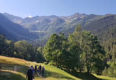
Ruta Senderismo de 12,2 km a descubrir en Auvergne-Rhône-Alpes, Isère, Le Haut-Bréda. Esta ruta ha sido propuesta por nadd73.
Descripción
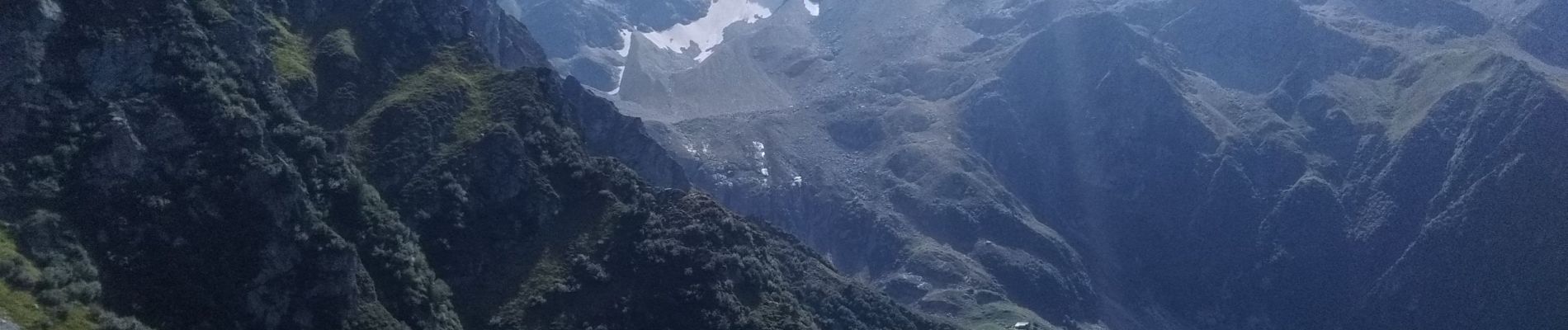
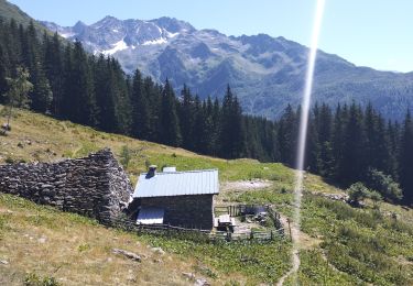
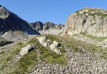
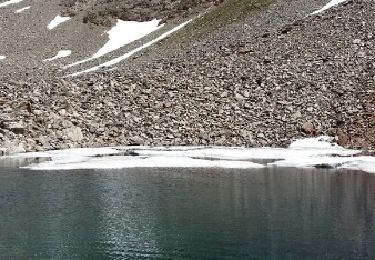
de Gleyzin, Bourgeat noire, monter comme au refuge de l'oule mais à 1570m bifurquer à gauche, au départ ça va ensuite un éboulement à défoncer le sentier. C'est raide, plein de cailloux et herbes, heureusement que les arcosses sont là. Après le col du Vay il faut mettre un peu les mains.
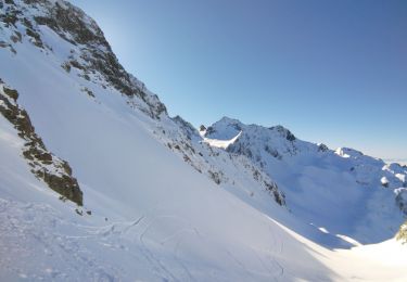
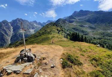
avant le dernier sommet il faut descendre un peu : attention raide piolet Utile. De même pour descendre la crête sud.
Attention itinéraire souvent hors sentier, raide et herbeux.
Piolet Utile
Localización
Comentarios
Excursiones cerca
![Excursión Senderismo Le Haut-Bréda - Lac Blanc Lac de la Folle - Photo](https://media.geolcdn.com/t/375/260/f4e38b80-48fc-49d4-b675-d255436e858e.jpg&format=jpg&maxdim=2)
![Senderismo Senderismo](https://static1.geolcdn.com/sitytour/trail-icons/101.png)
Senderismo
![](/images/other/stat-length.png)
![](https://static1.geolcdn.com/siteimages/upload/files/16400158638029165_repeat_loop_refresh_sync_direction_icon.png)
![Excursión Senderismo Le Haut-Bréda - Lac de Moretan avec bivouac - Photo](https://media.geolcdn.com/t/375/260/3f6f6c9a-9eda-4898-9aca-c8a8ce663caf.jpg&format=jpg&maxdim=2)
![Senderismo Senderismo](https://static1.geolcdn.com/sitytour/trail-icons/101.png)
Senderismo
![](/images/other/stat-length.png)
![](https://static1.geolcdn.com/siteimages/upload/files/16400158638029165_repeat_loop_refresh_sync_direction_icon.png)
![Excursión Esquí de fondo Le Haut-Bréda - Col de Morétan - Photo](https://media.geolcdn.com/t/375/260/873ab7f9-f7ca-4112-a0d8-deee5e8e09db.jpg&format=jpg&maxdim=2)
![Esquí de fondo Esquí de fondo](https://static1.geolcdn.com/sitytour/trail-icons/503.png)
Esquí de fondo
![](/images/other/stat-length.png)
![](https://static1.geolcdn.com/siteimages/upload/files/16400158638029165_repeat_loop_refresh_sync_direction_icon.png)
![Excursión Senderismo Le Haut-Bréda - 2jours dans la vallée de la Valloire - Photo](https://media.geolcdn.com/t/375/260/9e9cf3b1-838d-469b-96fa-b30ad43a1a59.jpg&format=jpg&maxdim=2)
![Senderismo Senderismo](https://static1.geolcdn.com/sitytour/trail-icons/101.png)
Senderismo
![](/images/other/stat-length.png)
![](https://static1.geolcdn.com/siteimages/upload/files/16400158638029165_repeat_loop_refresh_sync_direction_icon.png)
![Excursión Senderismo Le Haut-Bréda - Refuge de l'Oule - Croix et Lac du Léat - Photo](https://media.geolcdn.com/t/375/260/078c0fe6-5867-4c5f-8f9e-655ab5779903.jpg&format=jpg&maxdim=2)
![Senderismo Senderismo](https://static1.geolcdn.com/sitytour/trail-icons/101.png)
Senderismo
![](/images/other/stat-length.png)
![](https://static1.geolcdn.com/siteimages/upload/files/16400158638029165_repeat_loop_refresh_sync_direction_icon.png)
![Excursión Senderismo Le Haut-Bréda - Lac et Croix du Léat - Photo](https://media.geolcdn.com/t/375/260/baf05127-eb6f-4a23-a9cc-3889b7723c4a.jpg&format=jpg&maxdim=2)
![Senderismo Senderismo](https://static1.geolcdn.com/sitytour/trail-icons/101.png)
Senderismo
![](/images/other/stat-length.png)
![](https://static1.geolcdn.com/siteimages/upload/files/16400158638029165_repeat_loop_refresh_sync_direction_icon.png)
![Excursión Raquetas de nieve Le Haut-Bréda - lac blanc de la grande valloire - Photo](https://media.geolcdn.com/t/375/260/2557f174-3a45-4bf5-8fe0-a92f7b11b384.jpg&format=jpg&maxdim=2)
![Raquetas de nieve Raquetas de nieve](https://static1.geolcdn.com/sitytour/trail-icons/504.png)
Raquetas de nieve
![](/images/other/stat-length.png)
![](https://static1.geolcdn.com/siteimages/upload/files/16400158638029165_repeat_loop_refresh_sync_direction_icon.png)
![Excursión A pie Le Haut-Bréda - Tour Pays Allevard - Photo](https://media.geolcdn.com/t/375/260/0a5c4a99-9cde-4ae9-a3b1-f2c7b44e7d78.jpeg&format=jpg&maxdim=2)
![A pie A pie](https://static1.geolcdn.com/sitytour/trail-icons/100.png)
A pie
![](/images/other/stat-length.png)
![](https://static1.geolcdn.com/siteimages/upload/files/16400158638029165_repeat_loop_refresh_sync_direction_icon.png)
![Excursión Senderismo Le Haut-Bréda - Lacs de la Valloire - Photo](https://media.geolcdn.com/t/375/260/ext.jpg?maxdim=2&url=https%3A%2F%2Fservices.sitytrail.com%2FGeolivesWS%2FDownloadMedia.ashx%3FTrailID%3D444560%26Media%3Dfix__20150712135131.jpg)
![Senderismo Senderismo](https://static1.geolcdn.com/sitytour/trail-icons/101.png)
Senderismo
![](/images/other/stat-length.png)
![](https://static1.geolcdn.com/siteimages/upload/files/16400158638029165_repeat_loop_refresh_sync_direction_icon.png)